

Coverage Area
PLEASE TAKE NOTE:
These maps apply only to coverage for Cloud Alliance. They do not show coverage for NEW Alliance, a related but separate fixed wireless broadband provider.
We have silo and barn-sited antennas in East Montpelier, Calais, and Marshfield and 100 to 130-foot, steel towers in Plainfield, Woodbury, Hardwick, and Wolcott. We equipped all of our facilities with antennas powered by LTE base stations for outstanding fixed-4G service.
Our service signals now reach a large portion of central Vermont as well as some of the Northeast Kingdom and virtually all of Plainfield, East Montpelier, Calais, Woodbury, and Hardwick, more than half of Marshfield, Cabot, Walden, Stannard, Wolcott, and smaller bits of Berlin, Middlesex, Elmore, Hyde Park, Craftsbury, Greensboro, Albany, Sheffield and other neighboring towns. We plan to continually upgrade our currently covered areas to reach even more locations.
Maps
These new, zoomable, coverage maps provide a representation of our full service area. They show both the increased LTE coverage in our original towns and the new coverage to the north resulting from our recent buildout.
On each map, the green areas indicate strong signal, with a high likelihood of service. The gray areas probably do not receive sufficient CloudBurst™ signal, at this time. If your location is in the gray, though, please don’t assume the worst. These maps are good but not perfect. Using our radio frequency propagation software, we can make precise point-to-point signal predictions for specific locations. Let us check for you.
[TIP: To view greater detail, expand your browser window to full screen width, before you zoom a map image.]
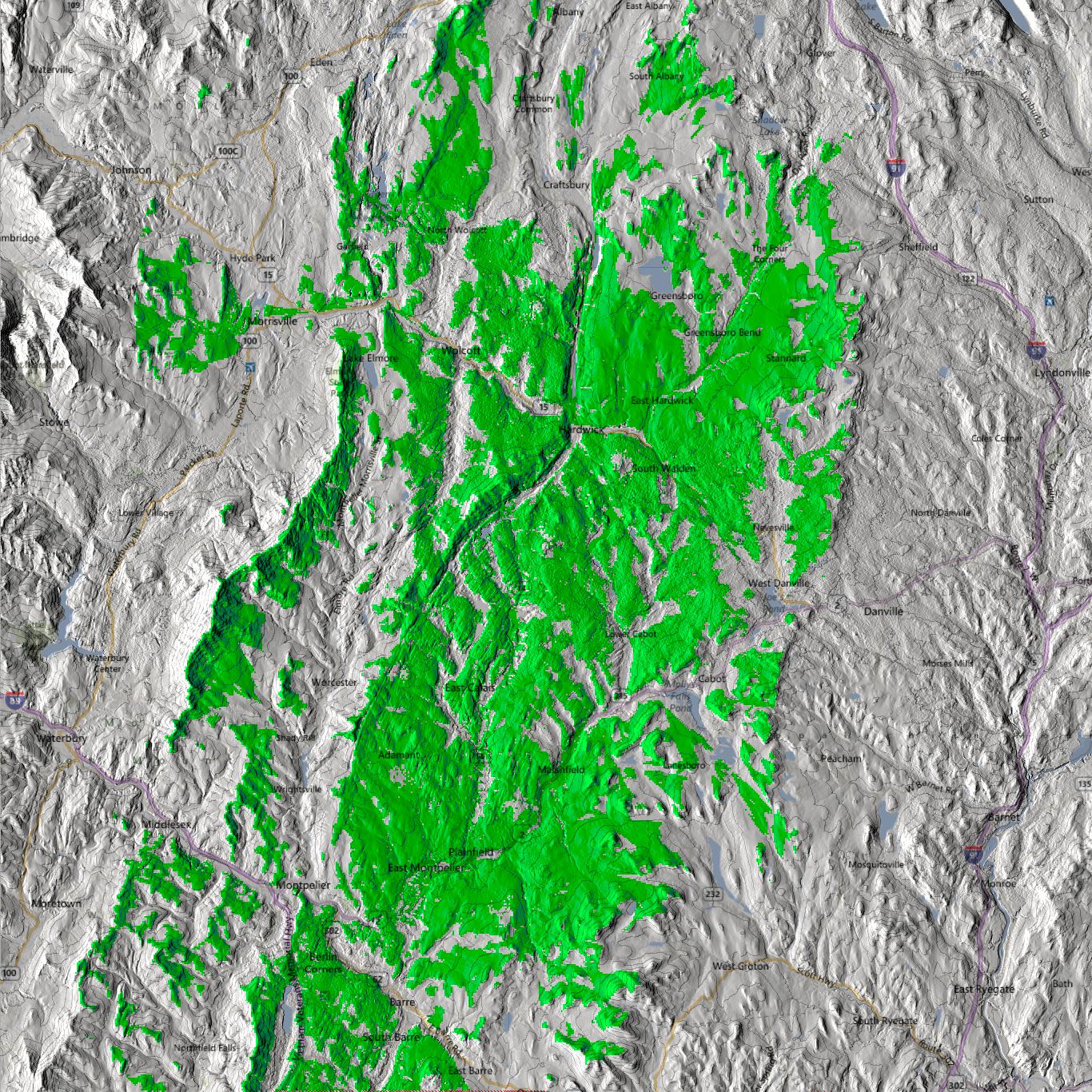
our entire coverage
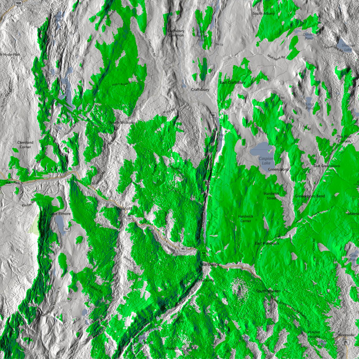
our northern coverage
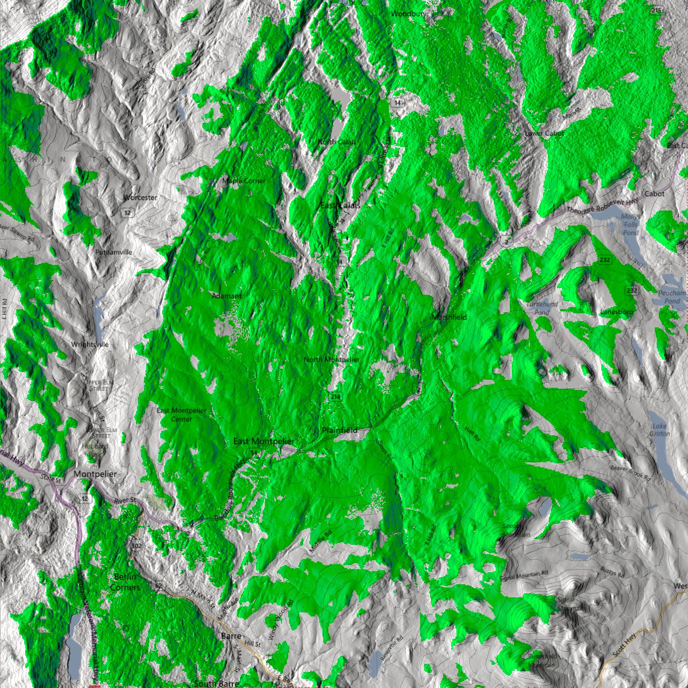
our southern coverage
Though our signals do not require a direct line-of-sight between station and subscriber, please keep in mind that every location in Vermont is unique, and some sites are blocked by terrain, structures, or dense forest. Therefore, we can’t make any service guarantees, in advance. The final service determination is made when the installation team reaches your location and performs a signal test.
Due to the nature of building a rural broadband network, expansions tend to progress slowly. However, steady installations continue month-by-month, all year round. Registered individuals will be contacted as soon we are able to schedule an installation. There are already hundreds on our list, so don’t delay! If you live outside the current coverage area, you should still register, because this will help us determine where to focus our future expansion efforts.